Mitigation measures
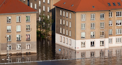
Flood
Recent observations indicate that global warming is responsible for heavier rainfall and flooding and more severe droughts. Across Europe, predictions are for more frequent events of high precipitation, wetter winters, and drier summers. Consequences for these changes include the decreasing availability of fresh water resources in some regions, as well as flooding and erosion of coastal and low-lying areas, imposing heavy costs on society and the economy. For example, between 1980 and 2011, 5.5 million people were affected by flooding which caused economic losses of more than €90bn (http://ec.europa.eu/clima/change/consequences/index_en.htm). We cannot stop the effects of global change, but there may be measures that we can take to mitigate the costs to society.
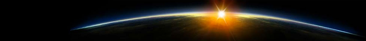
Earth Observation (EO) satellites provide a wealth of data for scientific, observational, and commercial exploitation. In many cases, however, the raw data are difficult for non-specialists to access, let alone interpret. The Horizon 2020 project ‘European Gravity Service for Improved Emergency Management’ (EGSIEM) will use global gravity fields derived from EO satellites to develop gravity-based indicators of extreme hydrological events, demonstrate their value for flood and drought monitoring, and examine their potential for early warning services.
Up until the end of the last century, monitoring temporal changes in the distribution of environmental mass had been quite challenging. However, since 2002, the German-American Gravity Recovery and Climate Experiment (GRACE), a satellite gravity mission, has demonstrated the potential and value of globally observing mass variations. GRACE observations have and continue to provide fundamental insights into the global water cycle, polar and mountain ice mass loss, changes in ocean surface currents, sea level rise as well as many other processes. Of particular importance to EGSIEM is the mass redistributions resulting from changes in continental water storage (liquid water or ice) that control the regional water budget and that can, in extreme cases, result in floods and droughts.
The timeliness and reliability of information is the primary concern for any monitoring/early warning system. The usefulness of EO data for emergency management is strongly dependent on the time delay between data reception to alert. EGSIEM aims to increase the temporal resolution (from one month to one day) and reduce the data latency (from the current two-month delay to five days or less – essentially near real time), which will translate into significant added value for warning and forecasting extreme hydrological events. Early warning indicators derived from near real-time mass redistribution products are expected to improve the timely monitoring of potentially evolving hydrological extremes, and to help in the scheduling of high-resolution follow-up observations, as is currently done with tropical storms as they approach the coast.
Like most EO data, interpreting satellite gravity data is still only possible by experts. One additional goal of the EGSIEM project is to expand the user community from purely scientific experts to the general public at large. The monitoring service, to be developed by the team, will include products in user-friendly, easy-to-interpret formats. Significant effort will be devoted to developing adequate visualisation tools.
The EGSIEM consortium is made up of eight European university and government organisations with expertise in gravity field data processing and interpretation and hydrological modelling. The University of Bern, Switzerland, co-ordinates the project.
Consortium Members
- University of Bern (Coordinator)
- University of Luxembourg
- Helmholtz-Zentrum Potsdam Deutsches GeoForschungsZentrum
- Technische Universität Graz
- Gottfried Wilhelm Leibniz Universität Hannover
- Centre National d’Études Spatiales
- Deutsches Zentrum für Luft- und Raumfahrt EV
- Géode & Cie
EGSIEM Project was awarded €2.5m for this three-year project
Dr Tonie M van Dam and Matthias Weigelt, University of Luxembourg
Adrian Jäggi (Coordinator), University of Bern
Faculté des Sciences, de la Technologie et de la Communication
University of Luxembourg
6, rue Richard Coudenhove-Kalergi
L-1359 Luxembourg
tel: +352 46 66 44 6261
fax: +352 46 66 44 6261
[email protected]
www.uni.lu